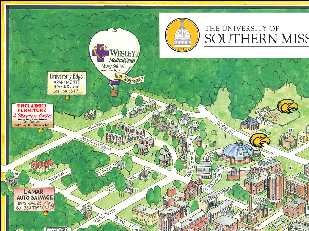
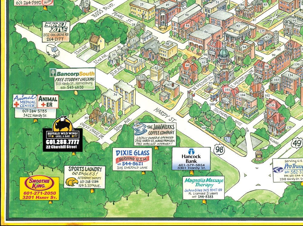
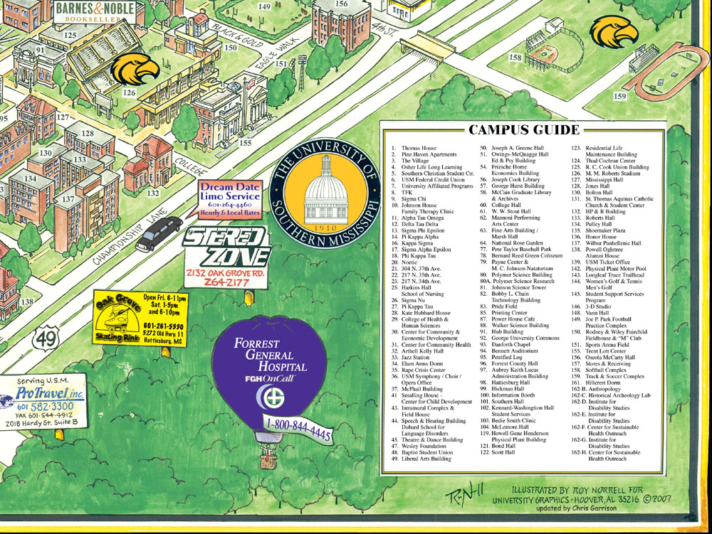
Here are some maps that I've revised for University Graphics / Creative Concepts, in Hoover, Alabama. Most of these were originally drawn by Roy Norrell, then updated by me for subsequent publication.
Monday, January 8, 2007
USM
Here's my update of a Roy Norrell illustration - The University of Southern Mississippi: Click these close-ups if you want to see more detail:
Hey! I live in Birmingham, Alabama, where I draw Our Heroes, a webcomic that appears on DummComics.com. I also do caricatures, draw storyboards for ads, and make cartoon animation. Take THAT!